PHOENIX: Parsimony, Huge Observations of Earth Non-stationarities from Images Time Series
[ANR Project on the characterization of large-scale earth variables, 2015-2019, Reference ANR-15-CE23-0012]
[ANR Program: Données massives et calcul intensif : enjeux et synergies pour la simulation numérique]
| Imaging |
☼ Remote Sensing (satellite)
☼ Proximal Sensing |
| Modality |
☼ Synthetic Aperture Radar
☼ Polarimetry Information |
| Modality |
☼ Optical-InfraRed
☼ Spectral Information |
| Analysis |
☼ Random Fields
☼ Wavelets |
| Data |
☼ Multivariate Image
☼ Image Time Series |
| Entropy |
☼ Distributed Information
☼ Multimodal Information |
| Field |
☼ Glacier Dynamics
☼ Glacier Textural State |
| Field |
☼ Landslide Detection
☼ Lava Flow Mapping |
| Field |
☼ Tropical Forest Monitoring
☼ Tropical Cyclone Tracking |
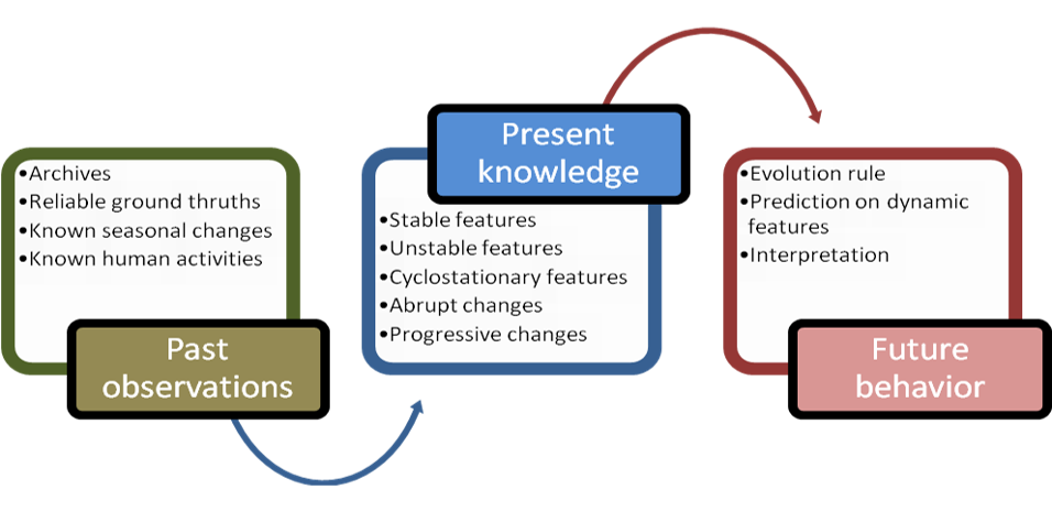
SUMMARY: Environment monitoring is crucial for understanding the relationship between climate change and changes in large scale earth structures such as glaciers and forests. For these big structures, monitoring temporal evolution or assessing resilience and adaptation of earth to changes requires the analysis of
time series composed of images.
When considering remote sensing imagery, analyzing such time series is actually facing dimensionality: observations are huge data both in time and space domains; in addition with intricacy when using coherent acquisition waves (radar imaging for instance). The challenge of remote sensing information science is then developing tools for handling dimensionality of data.
The scientific objective of the PHOENIX project is to provide non-stationary multidimensional models for easing information mining and retrieval in long sequences of multisource/distributed image time series issued from recent constellations of satellites. These models will be used to characterize the evolution of earth structures such as glaciers and forests.
- University Savoie Mont Blanc, France (LISTIC, EA 3703) / MAIN PARTNER
- Abdourrahmane M. ATTO (PhD, Applied mathematics)
- Alexandre BENOIT (PhD, Computer vision)
- Emmanuel TROUVÉ (PhD, Image processing and remote sensing)
- Flavien VERNIER (PhD, Computer science)
- Gilles MAURIS (PhD, Information processing)
- Guillaume GINOLHAC (PhD, Statistical signal processing)
- Nicolas MEGER (PhD, Data mining)
- Philippe BOLON (PhD, Image processing)
- Charles LESNIEWSKA-CHOQUET (PhD student, Image processing and computer vision)
- Héla HADHRI (PhD student, Image processing and computer vision)
-
Associate experts (Advisory Team)
- Aluisio de S. PINHEIRO (University of Campinas, Brazil)
- Catherine POTHIER (INSA Lyon, France)
- Christophe RIGOTTI (INSA Lyon, France)
- Florence TUPIN (Image processing and remote sensing)
- Grégoire MERCIER (Image processing and remote sensing)
- Jean-Marie NICOLAS (Télécom ParisTech, France)
- Jean-Paul RUDANT (University Paris-East-Marne-La-Vallée, France)
- Jean-Philippe OVARLEZ (ONERA/SONDRA, France)
- Lionel FILLATRE (University of Nice, France)
- Pedro A. MORETTIN (University of São Paulo, Brazil)
- Yannick BERTHOUMIEU (University of Bordeaux 1, France)